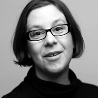
L. Monika Moskal
- Courses4
- Reviews6
- School: Missouri State University
- Campus:
- Department: Geography
- Email address: Join to see
- Phone: Join to see
-
Location:
901 S National Ave
Springfield, MO - 65897 - Dates at Missouri State University: June 2005 - July 2006
- Office Hours: Join to see
Biography
Missouri State University - Geography
Resume
2013
NASA Panel
UW Remote Senisng and Geospatial Analysis Laboratory
Precision Forestry Cooperative
NASA Panel
President
ASPRS Puget Sound Region
Precision Forestry Cooperative
University of Washington
Director
Greater Seattle Area
Dr. L. Monika Moskal is an Associate Professor of Remote Sensing at the University of Washington (UW)
College of the Environment
School of Environmental and Forest Sciences (SEFS); where she is the Director of the Precision Forestry Cooperative and the Remote Sensing and Geospatial Analysis Laboratory(RSGAL)
she is also the Associate Director of (SEFS). She is one of the core faculty in the UW Precision Forestry Cooperative and is affiliated with the UW BioEnergy IGERT and the UW Interdisciplinary PhD Program in Urban Design and Planning. She is also the Faculty Advisor for the UW-Geospatial Club and a board member and past President of the Puget Sound American Society for Photogrammetry and Remote Sensing - ASPRS.
Associate Professor of Remote Sensing & Associate Director
University of Washington ~ School of Environmental and Forest Sciences
2000
PhD
Remote Sensing and GIS
1997
University of Calgary
University of Washington ~ School of Environmental and Forest Sciences
ASPRS Puget Sound Region
Missouri State University
Missouri State University
PI and Executive Director
Dr. L. M. Moskal's Remote Sensing and Geospatial Analysis Laboratory (RSGAL) is the remote sensing and geospatial research partner of the Precision Forestry Cooperative in the College of the Environment
School of Forest Resources at the University of Washington. The laboratory was established in 2003 and originally located at Missouri State University (2003-2006)
it continues to be directed by Dr. L. Monika Moskal.
UW Remote Senisng and Geospatial Analysis Laboratory
University of Calgary
MS
Remote Sensing and GIS
1992
Polish
English
BES (Honors)
Environmental Studies (Remote Sensing and GIS)
LiDAR
Science
Statistics
Environmental Awareness
ArcGIS
Natural Resource Management
Photogrammetry
Forestry
Analysis
Remote Sensing
Higher Education
University Teaching
Watershed Management
Geomatics
Precision Forestry
Spatial Analysis
Biodiversity
Spatial Databases
GIS
Quantification of landscape change from satellite remote sensing
M.J. Hansen
E.E. Dickson
S.E. Franklin
Satellite remote sensing data and methods can be used to develop maps of large areas at different times in order to assess changes in forest ecosystem patterns and processes. Such maps are useful in understanding wildlife populations and habitat
forest biodiversity
and forest productivity. They may be important in ecological monitoring programs at multiple spatial and temporal scales
and could include assessment of structural aspects of the landscape
such as forest or habitat fragmentation. Quantification and measurement of landscape structure depend on the definition of landscape classes or patches
defined on the basis of more or less homogeneous elements
which differ in some measurable way from neighbouring patches. In this paper
we review some of the issues
and provide examples using satellite remote sensing data
in the quantification of landscape structure in two Canadian forests. The link between landscape structure and biodiversity is provided through the emergence of ecological understanding of species richness
species-habitat or niches
and metapopulation dynamics.
Quantification of landscape change from satellite remote sensing
Darlene Zabowskie
Hyperspectral Analysis of Soil Nitrogen
Carbon
Carbonate
and Organic Matter Using Regression Trees
Ruiz LA
Cooos
N.C.
Deriving pseudo-vertical waveforms from small-footprint full-waveform LiDAR data
Ruiz LA
Cooos
N.C.
Deriving pseudo-vertical waveforms from small-footprint full-waveform LiDAR data
L. Monika
Moskal
PhD
Possible Matching Profiles
The following profiles may or may not be the same professor:
- L. Monika Moskal
University of Washington - Forestry


