Daren T. Nelson
- Courses1
- Reviews2
- School: University of North Carolina
- Campus: Pembroke
- Department: Geology
- Email address: Join to see
- Phone: Join to see
-
Location:
1 University Drive
Pembroke, NC - 28372 - Dates at University of North Carolina: March 2018 - April 2018
- Office Hours: Join to see
Biography
University of North Carolina Pembroke - Geology
Resume
2010
Boy Scouts of America
Environmental Science
Hydrogeology
Geological Mapping
Soil
Groundwater
Sampling
Research
Hydrology
Remote Sensing
Geophysics
Geography
Geology
Water
Earth Science
Science
Geomorphology
Analysis
Field Work
Water Resources
Climate Change
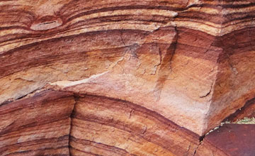
THE OSCILLATORY RECORD OF LATE PLEISTOCENE TRANSGRESSIVE PALEOSHORELINES OF LAKE BONNEVILLE
New stratigraphic and chronological data within the lacustrine sediments of the Hogup Mountains of northwestern Utah provide evidence for two previously unpublished oscillations and further evidence for another previously proposed oscillation in the transgressive record of late Pleistocene Lake Bonneville. Since the lake’s level is closely tied to climatic responses
resolving stratigraphic and chronologic history has the potential to improve the resolution of regional and global paleoclimate models. The sedimentological deposits at this site are related to the transgressive paleoshorelines between the altitudinal limits of the Bonneville and Provo levels (Intermediate paleoshorelines). Including the two newly proposed oscillatory events from this paper
there are seven proposed oscillatory events during the transgressive phase (25 – 14.5 14C kyr B.P.) of Lake Bonneville: two Stansbury oscillations (~21.5 and 20.5 14C kyr B.P.)
the U1 oscillation (~18.6 14C kyr B.P.)
the newly proposed Lower Hogup Oscillation (~18.2 14C kyr B.P.)
the U2 oscillation (~17.5 14C kyr B.P.)
the newly proposed Upper Hogup Oscillation (17.2 14C kyr B.P.)
and the U3 oscillation (~16.4 14C kyr B.P.). It is proposed that these Intermediate oscillations record sub-millennial oscillations in the lake level that likely correlate to short-term climate shifts during the Last Glacial Maximum.
THE OSCILLATORY RECORD OF LATE PLEISTOCENE TRANSGRESSIVE PALEOSHORELINES OF LAKE BONNEVILLE
During 2008-2009 the United States Geological Survey's EDMAP program has been funding the surficial mapping of the Hogup Bar 7.5'quadrangle in northwestern Utah. The Hogup Bar quadrangle was selected due to the presence of deposits that exhibit all of the basin's major well established stillstands and highstands and due to the presence of many other transgressive stillstands. The chronology of the major highstands of Lake Bonneville and the basin's broad climatic history is well established; however
the chronology of many the basin's small-scale base-level changes is still poorly defined. With the large drop of base-level in the Bonneville Basin during the Late Pleistocene and Holocene
many lacustrine landforms that were deposited during the transgressive occupation of Lake Bonneville have been deeply incised by gullies. Gully incisions in the Hogup Bar quadrangle of northwestern Utah
express well exposed stratigraphy used to make detailed sedimentological descriptions of the lake's transgressive lacustrine landforms. Based on clast lithology
imbrications
and some other geomorphic proxies of longshore transport within the region
it has been determined that the sediment sources for many of these transgressive landforms are from large relict alluvial fans that were reworked during the transgression of the lake. The mapping of the region's surficial sediments allow for the identification of past localities within the quadrangle that were predominantly depositional and/or erosional environments. The stratigraphy of these transgressive landforms provides basic age relationships for many of the lake's stillstands
and may even suggest that there have also been some significant oscillations in the lake's base-level during its transgressive record.
Insights from mapping surficial deposits associated with the transgressive rise of Lake Bonneville in northwestern Utah.
Effective management of limited groundwater and surface water resources require an understanding of the complex interaction between surface water and groundwater flow regimes. The Eastern Snake River Plain hosts a hydrogeological regime that is characterized by extensive interactions between surface water (Snake River) and a fractured basalt aquifer (Eastern Snake River Plain Aquifer
ESRPA). Because of aquifer heterogeneity and uncertainties in surface and groundwater interactions
delineation of regional groundwater flow paths and the extent of mixing of surface and groundwater are difficult to quantify
especially near the Snake River. Natural abundances of dissolved rare earth elements (REE) have been used as tracers in other aquifer systems to investigate source water mixing and water rock interactions. Dissolved REE are ideally suited for this purpose because they exhibit subtle systematic changes with increasing atomic number. Specifically
we have used dissolved REE as a natural tracer in the ESRPA to understand the role of surface and groundwater interactions on the geochemistry and flow in the aquifer.\n\nMultivariate statistical analyses of the geochemical data suggested that a) surface water interactions in the ESRPA heavily influence the aquifer�s geochemistry
b) groundwater along the two flow paths are significantly different
and c) groundwater has been modified by transpiration. In areas dominated by groundwater irrigation
REE patterns often resemble the REE pattern of the basalt and/or possibly the clay and carbonate components of the aquifer. In areas dominated by surface water irrigation
REE patterns are fractionated and exhibit light REE depletions. Our results show that REE can be used to assess the extent of surface water recharge and water rock interactions and may prove useful to better quantify regional groundwater flow patterns.
Effective management of limited groundwater and surface water resources require an understanding of the complex interaction between surface water and groundwater flow regimes. The Eastern Snake River Plain hosts a hydrogeological regime that is characteri
The mission of the Robeson County Ground Water Project is to monitor the impacts of ground water use on the Black Creek Aquifer
specifically in Robeson County
so that water users can better understand how the water flows in the aquifer
how it is currently being used
and to plan for future use. Undergraduate interns are working with their faculty mentor to help site up to 15 monitoring wells across the county and on the UNCP campus. Through collection and analysis of measurements taken from these wells and the merging of other county
state
and national data we have been able to monitor the variations in ground water levels of the aquifer from the 1940s to present day. The data collected is being used to create a regional publicly accessible database that categorizes ground water data based on the well used to record it. Undergraduates create well construction and formation diagrams for each of the wells in the database by synthesizing all the data we have for each well
create monthly piezometric maps for the local region based on the measurements from the wells
and a report of these findings are reported to the county on a semi-annual basis. The monitoring of the ground water in the region and the database will hopefully act as a reference for water managers to determine how increased industrial and agricultural uses are impacting our local groundwater systems and to effectively manage the resource. The program has been a great way to help connect undergraduates with industry leaders and public administrators but also has been an opportunity to help our campus and community members to learn more about their local water resources.
The Robeson County Groundwater Project: A partnership with the community.
Geologic Map of the surficial deposits relating to Lake Bonneville within the Hogup Bar Quadrangle of northwestern Utah
GEOLOGIC MAP OF UNCONSOLIDATED DEPOSITS IN THE HOGUP BAR QUADRANGLE
BOX ELDER COUNTY
UTAH
The Gold Hill District of North Carolina has been a place of historical significance from Gold Hill’s first discovery of proven gold veins in 1824. Since then extensive mining operations continued until operations were ceased in 1915. In the past decade the remains of the Gold Hill mining district has left many existing surface hazards
as well as the potential for future hazards relating to concentrated subsidence from filled mine shafts and stopped areas. The primary concern for the local community of Gold Hill is to know the magnitude of the hazards and to understand where potential hazards are located. To identify potential hazards we have completed some exploratory Ground Penetrating Radar (GPR) surveys that allows us to map the concentrated subsidence at various locations throughout the Gold Hill mining district. The GPR is being used to create both two dimensional and three dimensional transects of the surface. Using various frequencies for different depths
it is possible to see that disturbances in the sediment exist
but the data only shows features to depths as shallow as five to ten meters. These shallow disturbances are of primary interest but could also point to larger scale issues. The application of the GPR technology allow for a better understanding of the past mining network that once flourished in the region and the hazard associated with the subsidence of the material within these old shafts.
PRELIMINARY HAZARD MAPS OF SUBSIDENCE NEAR GOLD HILL
NC
During the height of the LGM
multiple paleoshorelines of late Pleistocene Lake Bonneville formed within the Bonneville basin. The depositional and chronologic history of the lake’s more significant paleoshorelines is well established. However
the “Intermediate” paleoshorelines have been poorly documented in the basin. The variations in the altitudinal limits of these paleoshorelines make their correlation and chronologic record difficult to decipher. \nTwo geologic maps were produced for unconsolidated sediments near Stockton
Utah and near Park Valley
Utah
to provide a geologic framework of the stratigraphic and geomorphic developmental and chronological record related to the Intermediate paleoshorelines. New data provided from these maps record two previously unpublished oscillatory events as well as evidence for previously proposed oscillatory events that occurred during the Intermediate phase of the lake. A model was also developed to correlate the Intermediate paleoshorelines within the basin
by updating and incorporating data from isostatic rebound models
by incorporating data from a model that predicts potential wave energy
and by incorporating sedimentological and geomorphic data from the paleoshorelines to explain why variations exist in the altitudes of the Intermediate features. The potential correlation of 6 significant Intermediate paleoshorelines suggest that the chronologic record of these features can be established. However
more chronological and sedimentological evidence needs to be obtained before the proposed chronology of the Intermediate paleoshorelines and the observed oscillatory events can fully be demonstrated. As further documentation and chronology of these intermediate paleoshoreline features are obtained it will elucidate how the lake has responded to past submillennial climatic shifts associated with the LGM and will lead to a better understanding of the risk associated with future oscillations of the lake’s surface. \n
The geomorphic and stratigraphic development of Lake Bonneville’s Intermediate paleoshorelines
UTILIZING IMPROVED METHODOLOGY TO DELINEATE PALEOWAVE ENERGY PROXIES OF LAKE BONNEVILLE
Early Observations of a Geomorphic Analysis Regarding Proxies that indicate Paleowave Energy Distribution in the Bonneville Basin.
The well-developed lacustrine landforms formed during the Late Pleistocene highstand of the pluvial Lake Bonneville in northwestern Utah demonstrate the complexity and diversity of coastal features in the Bonneville Basin. In various localities in the basin lacustrine features
such as wave platforms and beach ridges
are being mapped and analyzed to refine the chronology of minor lake level fluctuations and to understand the factors that affected the distribution of wave energy. The mapping of the distribution of bedrock/sediment controlled platforms
tufa development
orientation of landforms (i.e. spits
bars
tombolos
beach ridges
and wave platforms)
and sediment transport
(provenance
grain size distribution
and source/supply) indicate that the largest and most erosive waves originated from the north and were primarily transporting sediment in a southerly direction. Since wave action is a direct consequence of wind speed and direction these observations indicate that the dominant wind and storm tracks were most likely coming from the north. These observations provide additional evidence that strong katabatic winds (Jewell
2007 in press) may have been coming off the ice sheet to the north of the lake and affected the local climate and landform development. In addition
land surveys (in progress) and recent airborne LiDAR acquisitions are providing very detailed elevation controls and profiles that provide detailed datasets for modeling the paleowave conditions required for the formation of wave platforms and coarse grained beach ridges. The wave energy distribution of these landforms should then provide additional constraints on the conditions of the local climate during the Late Pleistocene.
Early Observations of a Geomorphic Analysis Regarding Proxies that indicate Paleowave Energy Distribution in the Bonneville Basin.
Beginning in the mid-20th century
the remote-sensing technologies of photogrammetry
LiDAR
and imaging spectroscopy have been a boon to the study of surficial processes throughout the world. Lake Bonneville research has benefited from these technologies ever since the advent of aerial photography
although each technology has its own particular strengths and weaknesses. Examples include elucidation of geomorphic features such as faint shorelines and investigation of mineralogy of playas resulting from the evaporation of Lake Bonneville. Future innovations promise to build on this rich legacy of Bonneville research.
Insights into Lake Bonneville using remote sensing and digital terrain tools
The Department of Geology and Geography at the University of North Carolina at Pembroke (UNCP) is teaming up with industry leaders and county and state administrators to analyze our local water resources so that we can sustainably use this resource. The Black Creek Aquifer is a primary ground water resource for five different counties in Southeast North Carolina and is the focus of this study. Undergraduate interns worked with their faculty mentor
county officials
and a local well driller to site 13 monitoring wells and 1 pumping well across the region. Each of the 15 wells in the network are monitored using pressure transducers and the data is collected and downloaded each month to a publically accessible database. The undergraduates create monthly piezometric maps for the local region based on the measurements from the wells and a report of these findings are reported to the county on a semi-annual basis. In addition the students collect well records from local well drillers
state and federal agencies and then analyze and map the data to provide a spatial database of many of the groundwater wells in the region. The students create well construction and formation diagrams for each of the wells in the database by synthesizing all the data we have for each well in order to simplify the records for the public. The monitoring of the ground water in the region and the database will hopefully act as a reference for water managers to determine how increased industrial and agricultural uses are impacting our local groundwater systems and to effectively manage the resource. The program has been a great way to help connect undergraduates with industry leaders and public administrators but also has been an opportunity to help our campus and community members to learn more about their local water resources.
Southeastern North Carolina Groundwater Database and Monitoring Network.
Rare earth elements as a natural tracer of groundwater flow within the Eastern Snake River Plain
Idaho
In the fall of 2016 the impacts of Hurricane Matthew caused over 22 deaths and estimates of over $1.5 billion in damage in North Carolina. The University of North Carolina at Pembroke was evacuated and closed and many students and faculty lost homes and possessions due to the damages incurred by the storm. As part of the InTeGrate research team
I had the unique opportunity to adapt and implement the \"Natural Hazards and Risks: Hurricanes\" module into my introductory Earth Science courses. The implementation of the module and analysis of student responses were analyzed over a control term (fall 15)
pilot term (spring 16)
and treatment term (fall 16). During the control course the students were taught in a traditional lecture style format regarding extreme weather events; whereas
in the pilot and treatment courses the InTeGrate module regarding hurricanes was implemented. The fall 2016 term was our \"treatment\" term where the implementation of this and other modules were in full swing. However
due to the storm it was decided that the students perceived interest would increase by further adapting the module to use Hurricane Matthew as an additional case study. As part of the presentation I will discuss how the module was adapted pre and post the storm. In addition
it will be discussed how adapting the InTeGrate module to relate to current and local events will increase student performance and interest. Data for the control
pilot
and treatment terms will be compared and discussed in relation to the disaster. In spring of 2017 the adapted post Hurricane Mathew version of the module was repeated and student experiences were collected to see if their personal experiences continued to improve student understanding.
Adapting the InTeGrate \"Natural Hazards and Risks: Hurricanes\" module in the wake of Hurricane Matthew
One of multiple authors (many not on LinkedIn)\n\nIntroductory
non-major geoscience courses provide a venue where students can develop new and valuable insights about important issues such as global sustainability and environmental challenges.\nThis report summarizes faculty experiences using materials from the InTeGrate project (http://serc.\ncarleton.edu/integrate) that actively engage students in learning about the Earth system in the context of\nsocietal issues. It is part of a larger study that includes assessing the effectiveness of the materials to improve student content learning and attitudes towards socially relevant issues. Eight faculty members from a range of institution types
class sizes
and course foci participated in a three semester-long\nresearch study designed to test the efficacy of replacing up to half of their existing geoscience course content with InTeGrate materials. Instructors documented instruction related reflections and collected pre- and post semester student performance and attitudinal data. They found that the immersive
data-rich\nactivities were adjustable to fit their specific curricular and logistical needs and could be readily updated to incorporate current events.
Integrating InTeGrate: Faculty Assess Classroom Experiences
Donna Cosgrove
Gary Johnson
Alan Wylie
Hydrologic interpretation of temporal variation in springs and wells in the Thousand Springs Area
Idaho
The University of North Carolina at Pembroke obtains drinking water from the City of Pembroke and irrigation water from a series of campus wells. That water ultimately comes from groundwater resources within the Cretaceous sediments of the Black Creek Aquifer. The confined aquifer lies approximately 70 – 80 feet below the surface of the campus and is under artesian pressure. This aquifer not only supplies the water to the campus and city but to most other nearby municipalities
domestic water-users
farms
and\nmuch of the industry within the region. The Department of Geology and Geography at the University of\nNorth Carolina at Pembroke (UNCP) is teaming up with industry leaders and county and state administrators to analyze our local water resources so that we can sustainably use this resource. The\nproject
named the Robeson County Groundwater Program (RCGP)
is designed to monitor ground water use across the region so that we can better understand how the water flows in the aquifer
how it is\ncurrently being used
and to plan for future use. A publically accessible database is also being formed as part of the project to help local and regional administrators to organize and display data related to the wells in the region.
The Robeson Groundwater Project: A partnership with the community.
The Hogup Bar quadrangle of northwestern Utah is a region with a diverse and rich archive of multiple coastal shorelines and landforms developed during the Late Pleistocene Lake Bonneville. Within the quadrangle multiple regressive and transgressive shorelines record the lakes elevations that are then related to patterns of paleoclimatic change. The lakes minor transgressive and regressive shorelines amid the major shorelines are still poorly understood due to the convoluted effects of isostatic rebound
past morphology
sediment sources
and potential climatic factors that drove the deposition and erosion of these laterally not continuous shorelines. An EDMAP sponsored geologic mapping project for the quadrangle has allowed the researchers to complete a detailed investigation of these shorelines in the Hogup Bar quadrangle. This mapping illustrates the complex relation of the both the transgressive and regressive shorelines and give a relative chronology of these minor shorelines in relation to the current understanding of the lakes history. The dating of these shorelines via radiocarbon and optically stimulated luminescence is currently underway in order to quantitatively improve the chronology of these less known aspects of the lake's history and how it relates to Late Pleistocene climate changes. In addition
the significant shoreline expressions seen in the bedrock platforms and depositional landforms within the quadrangle suggest that strong northerly wind events were frequent during the Late Pleistocene and could be due to a katabatic effect caused by the presence of the large continental ice sheet to the north of the lake.
Shoreline development in the Hogup Bar Quadrangle
northwestern Utah
during Late Pleistocene Lake Bonneville
New stratigraphic and chronological data within the lacustrine sediments of the Hogup Mountains of northwestern Utah provide evidence for two previously unpublished oscillations and further evidence for another previously proposed oscillations in the transgressive record of late Pleistocene Lake Bonneville. Including the two newly proposed oscillatory events from this paper
there are seven proposed oscillatory events during the transgressive phase of Lake Bonneville. It is proposed that the interpretation of these shorezone sediments record multiple unknown oscillations in the lake’s water level that correlate to fluctuations in the climate during the Last Glacial Maximum.
Transgressive stratographic record and possible oscillations of Late Pleistocene Lake Bonneville
Northern Hogup mountains
Utah
U.S.A.
Multiple transgressive shorelines of the late Pleistocene Lake Bonneville in northwestern Utah
USA have been identified between the altitudinal limits of the Bonneville and Provo levels and were named by the G.K. Gilbert as the “Intermediate” shorelines (1890). The chronologic record of these Intermediate shorelines is relatively unknown because they have not been correlated in the basin due to their individual altitudinal variations. The complexity of the altitudinal variations associated with the Intermediate shorelines has been attributed to differential hydro isostatic rebound patterns
differential wave energy patterns
and autogenic sedimentological processes related to an oscillating lake. In order to correlate the features locally and basin wide
modern GIS technologies are coupled with field investigations of the sedimentological and geomorphic patterns of the features. High resolution digital elevation models were utilized in a hydrostatic rebound model and then a potential wave energy model was developed by incorporating fetch and slope as proxies for wave energy. Both of these models
coupled with field investigations
are used to quantify factors that influence the development of shorelines in a complex lacustrine system. Six significant and multiple small Intermediate shorelines are correlated in the northwestern portion of the Bonneville basin (Hogup Mountains and Matlin Mountain) and within a southern arm of the basin (Wah Wah valley). Correlation of these shorelines allows a more accurate history of the shorelines and the basins climatic history to be determined. Correlating these Intermediate shorelines also has the potential to further aid in the understanding of how the lake may have responded to regional and/or global submillennial climatic shifts and how the basin may respond to these same type of climatic shifts in the future.
Correlation of the late Pleistocene “Intermediate” shorelines of Lake Bonneville
U.S.A.
Part of a national research team regarding teaching sustainability and improving geoscience education. Project involves studying how students interact with multiple new teaching modules that have been incorporated into the classroom and then analyzing if the modules improve learning.
2008
EDMAP (2008-2009)
United Stated Geological Survey - P.I. (Paul W. Jewell); Co-P.I. (Daren T. Nelson)
2006
Doctor of Philosophy (Ph.D.)
Geology
University of Utah
2003
Master of Science (M.S.)
Hydrology
University of Idaho
1998
Bachelor of Science (B.S.)
Geology
Utah State University
1995
Full-time volunteer/missionary for two years in Glendale
Snowflake
and Holbrook
Arizona. Part-time volunteer for church activities at multiple localities.
The Church of Jesus Christ of Latter-day Saints
500
EDMAP (2007-2008)
United States Geological Survey - P.I. (Paul W. Jewell); Co-P.I. (Daren T. Nelson): $2
Daren
Nelson
Utah Valley University
University of North Carolina at Pembroke
Montana State University
University of Memphis
Brigham Young University - Idaho
University of Utah
Brockway Engineering
Pembroke
NC
I was responsible for teaching courses in Earth Science
Environmental Geology
Geomorphology
Hydrology/Hydrogeology
GIS for the Sciences and other courses as needed. I am always interested in local regional geology and hydrology. I am also currently the director for the Robeson County Groundwater Project. I am continuing to do research in the paleoclimatic history of lacustrine basins within the Great Basin of the Western United States and am involved with developing a geoeducation project called REVEAL the Geosciences: regarding the use of technology (i.e. Gigapans
Google Earth
3-D modeling or rocks
and virtual field trips) in introductory Earth Science classrooms.
Assistant Professor of Environmental Geology
University of North Carolina at Pembroke
Orem
Utah
Assistant Professor
Utah Valley University
Research and mapping geomorphic and sedimentologic development of lacustrine systems in ancient environments specifically related to the Lake Bonneville Basin. Also responsible for instructing and assisting with the instruction of courses & labs for the Geology and Geophysics Department.
University of Utah
Montana State University
Bozeman
Montana
Responsible for advising undergraduates and teaching the Geomorphology
Mountain Geography
Environmental Geology
and Hydrogeology courses.
Visiting Assistant Professor
Responsible as a consultant to a variety of different clients regarding water resource and issues in the State of Idaho. Particularly responsible for water law/right evaluations/transfers
hydrogeologic analyses
geochemical analyses
soil analyses
ground water development/well construction
and most field operations.
Brockway Engineering
Temporary Faculty
Full time faculty member responsible for teaching non-major and major coursework within the Geology Department. A member of the teaching and course development team for FDSCI 101: Foundations of Science
teaching member for the FDSCI 201: Natural Disasters team
GEO 101: Intro to Geology
GEO 340: Intro to GIS/GPS
and an undergraduate research mentor.
Brigham Young University - Idaho
University of Memphis
Was responsible for teaching courses and labs in the courses titled Landforms
Physical Geology
and a graduate Seminar in Applications of GIS in Geomorphology. Also responsible for assisting with advising Graduate research projects.
Earth Science Instructor
Greater Memphis Area
The National Association of Geoscience Teachers
Council of Undergraduate Research
Geological Society of America
Graduate Student Research Award for “Refining the paleoclimatic record of Lake Bonneville: The analysis of the transgressive lacustrine record and its implications for regional climatic change during the Late Pleistocene.”
Limnogeology Division of the Geological Society of America
William Lee Stokes Research Fellowship
Departmental fellowship for outstanding research in sedimentary geology
Department of Geology and Geophysics
Clyde T. Hardy Scholarship
Departmental scholarship for outstanding field geology skills
Utah State University Department of Geology
UNCP - College of Arts and Science Dean Grant
Funding for the development of two Augmented Virtual Sandboxes for demonstration at local schools and in the Geology Lab. ($1
200)
College of Arts and Sciences - UNCP
James F. Fitzgerald Memorial Scholarship
Departmental scholarship for outstanding research within the study of Idaho’s volcanic rocks
University of Idaho Department of Geology
Outstanding Teaching Assistant Award
Recognition for outstanding performance as a TA
College of Mines and Earth Sciences
115
Robeson Groundwater Monitoring Project (2016-2019)
Project involves providing consulting services for Robeson County water department in regards to drilling new wells
monitoring the groundwater resources within the region
and maintaining a database regarding the resource (https://arcg.is/0Se4T8). The project entails studying the hydrogeological properties of the Black Creek Aquifer in SE NC and helps connect industry
academia
and government agencies to help monitor water resources. Funding covers the training of multiple undergraduate interns for the project each term. 3 year: $138
R.E.V.E.A.L the Geosciences (Research Experiences and Virtual Exploration for Accelerated Learning) project
The project involves using GigaPan technologies (http://gigapan.com/profiles/darentn)
Google Earth
& 3D Modeling (https://sketchfab.com/dtnelson) to produce virtual field experiences and online lab activities for students who cannot go into the field and for online courses (https://darennelson.wixsite.com/reveal-geo-nc). ($7
000 - funded my an assortment of sources through UNCP)
Possible Matching Profiles
The following profiles may or may not be the same professor:
- Daren Nelson (20% Match)
Tenure Track Faculty F
Clark College - Clark College